A map of Europe from an US American perspective. Take a look at The Ultimate Bigot's Calendar of Europe from Yanko Tsvetkov's Mapping Stereotypes project. It features 12 maps with funny national prejudices and stereotypes about Europe according to the USA, Great Britain, Germany, France, Italy, Russia, Switzerland, Turkey, the Vatican, Poland, Bulgaria and Greece: The Ultimate Bigot's Calendar of Europe
Continue reading
Tag Archives: cartography
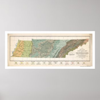
Tennessee Agriculture Map 1896 Posters
From the largest and most comprehensive cartographic collection in the world, Zazzle brings you this commemorative poster print featuring a large scale reproduction of a map of Tennessee agriculture based on the distribution of geological formations in 1896.
Continue reading
The Ultimate Bigot's Supersized Calendar 2013-14
A 24-month calendar featuring a selection of satirical world and regional maps from Yanko Tsvetkov's Mapping Stereotypes project, poking fun at prejudices and national stereotypes on the continent. Contains maps of Europe according to the USA, Great Britain, Germany, France, Italy, Russia, Switzerland, Turkey, the Vatican, Poland, Bulgaria, Greece, Spain, Silvio Berlusconi, gay men, male body height. Also contains maps of the world according to the USA. a map of the Arab Spring and Greater London.
Continue reading
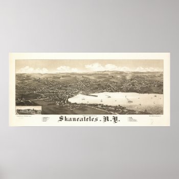
1884 Skaneateles, NY Birds Eye View Panoramic Map Poster
1884 Panoramic Map, a birds eye view of Skaneateles, NY. See my Zazzle store to find your Panoramic Birds Eye View Map.
Continue reading
Cool 3D Leopard Fur Map of AFRICA Necktie
If you have a passion for Africa and the great Leopard, this collection should prove appealing. Designed for lovers of the great African continent, we present this classy array of high quality gift items. 25% of proceeds are donated directly to the great humanitarian organization, World Vision.
Continue reading
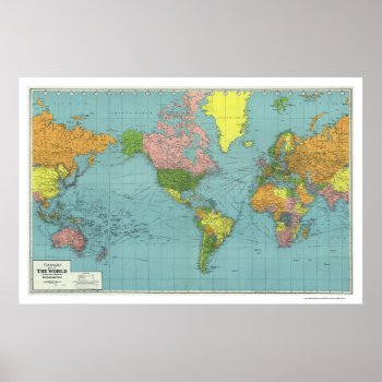
Detailed WWII World Map 1942 Posters
From the largest and most comprehensive cartographic collection in the world, Zazzle brings you this commemorative poster print featuring A highly detailed map of the world based on Mercator's Projection; showing the areas occupied by Germany during World War II. a map references principal railways, shipping routes (distances in nautical miles), coaling stations, wireless stations, etc.; created in 1942.
Continue reading
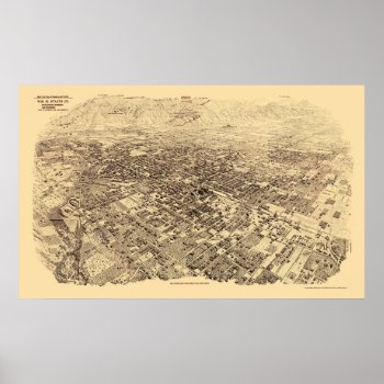
Pasadena, CA Panoramic Map – 1903 Posters
From the largest and most comprehensive cartographic collection in the world, Zazzle brings you this commemorative poster print featuring a panoramic view of the city of Pasadena, California was originally produced by Wm. R. Staats Co. in 1903. The map identifies points of interest in Pasadena more than a century ago. The printed detail is outstanding.
Continue reading
Vintage Antique Old World Map by Pieter Goos, 1666 Greeting Cards
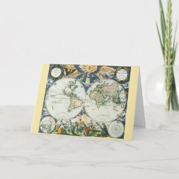
Vintage illustration antique world map featuring birds flying towards a shining sun casting rays over the hemispheres and continents. Below the chart is a set of allegorical figures representing the four seasons, summer, autumn, spring and winter. Orbis terrarum nova et accuratissima tabula. Artist: Pieter Goos, 1666.
Continue reading
The Ultimate Bigot's Calendar of Europe 2013
A 12-month calendar featuring a selection of satirical European maps from Yanko Tsvetkov's Mapping Stereotypes project, poking fun at prejudices and national stereotypes on the continent. Contains maps according to the USA, Great Britain, Germany, France, Italy, Russia, Switzerland, Turkey, the Vatican, Poland, Bulgaria and Greece.
Continue reading


