
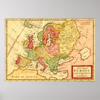
Title: A New Map of Europe According to the Newest Observations Cartographer: H. (Herman) Moll Year Published circa 1750s Description: Nicely hand colored. Covers Europe from the Western (Atlantic) Ocean to the European area of “Russia or Dominions of Moscovy.” A large undetailed “Part of Asia” lies to the east. The Black Sea is also named the Euxine Sea. “Turky in Europe” covers present day Greece, Albania, Bulgaria, etcetera.