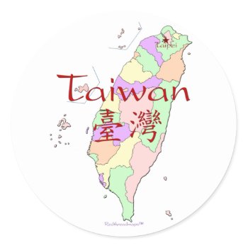
Beautiful Taiwan map design features a colorful map of the Republic of China showing the political divisions (includes the outer islands) and with the capital city, Taipei, highlighted. The traditional Chinese characters for Taiwan are included on the map. A unique Taiwan adoption gift, or present for Taiwanese family members. Designed by Hendrika of www.RedThreadMaps.com
Tag Archives: map
Isle of Chance Treasure Map Posters
You're really taking your chances when you embark on a career of piracy and swashbuckling. You face a world of harrowing seas, shipwrecks, ambushes, planks to be walked, homesickness, gun battles, and so on… but then again, pirates were the first employers to offer worker's compensation (600 pieces of eight for loss of a right arm, 100 pieces of eight for the loss of an eye or a finger*) so there are pros for the cons. Regardless, you'll need a good map to keep track of your treasure, and this one's a treasure itself. It lays out all of the dangers for you, crystal clear, so you can find the seven chests of stolen gold without loss of limb or life. And yet, those chests have been sitting there since 1692, so maybe they're not all that easy to find after all. Best of luck to you. This poster of original artwork by Alison Murray Whittington is the perfect gift for pirates, sailors, buccaneers, swashbucklers, adventurers, story-tellers, and children of all ages.
Continue reading
Washington, PA Panoramic Map – 1897 Poster
From the largest and most comprehensive cartographic collection in the world, Zazzle brings you this commemorative poster print featuring a panoramic view of the city of Washington, Pennsylvania was originally drawn by T.M. Fowler in 1897. The map identifies the street names and points of interest in Washington more than a century ago. The printed detail is outstanding.
Continue reading
San Antonio TX Post Card
San Antonio Texas
Continue reading
Antique 18th Century Map of Europe Herman Moll Print
Title: A New Map of Europe According to the Newest Observations Cartographer: H. (Herman) Moll Year Published circa 1750s Description: Nicely hand colored. Covers Europe from the Western (Atlantic) Ocean to the European area of “Russia or Dominions of Moscovy.” A large undetailed “Part of Asia” lies to the east. The Black Sea is also named the Euxine Sea. “Turky in Europe” covers present day Greece, Albania, Bulgaria, etcetera.
Continue reading
City of Charleston, South Carolina Postage Stamp
City of Charleston. By Rogers, Henry Darwin ; Johnston, Alexander Keith, 1804-1871 (185). Published by ''London: Edward Stanford''.
Continue reading
City Of New York Map 1755 Print
From the largest and most comprehensive cartographic collection in the world, Zazzle brings you this commemorative poster print featuring a reproduction of an early map plan of the city of New York from an actual survey; created by Francis Maerschalck in 1755.
Continue reading
Map of the Settled Wisconsin Territory Post Cards
Map of the Settled Part of Wisconsin Territory. By Abel, Henry J. ; Young, James H. (183). Published by ''Wisconsin Territory: Henry J. Abel''.
Continue reading
An Authentic 1690 Pirate Map (with embellishments) Postcards
This is a real Pirate Map from 1690, but the part about the treasure (i.e. the narrative on the bottom, the title I added on top, and all the stuff in red) is made up. I added it just for fun, and it has no basis in any historic facts whatsoever. The map is from “Hack's descript of ye East Indies”, also known as The Buccaneer Atlas because it is based on the experience of William Hacke (the cartographer) in association with Captain Bartholomew Sharpe, the notorious Buccaneer, on various expeditions to the South Seas. No buried treasure, but a navigational aid for finding hidden rivers, bays and other hideaways or site for ambuscades. See my other maps for an unembellished version.
Continue reading
The Bay of Honduras Print
The Bay of Honduras. By Jefferys, Thomas (177). Published by ''London: Sayer and Bennett”.
Continue reading