
ImageID: 42-15403080 / Christopher Talbot Frank / Photex/Corbis / Grand Teton National Park, Wyoming, USA
Continue reading

ImageID: 42-15403080 / Christopher Talbot Frank / Photex/Corbis / Grand Teton National Park, Wyoming, USA
Continue reading
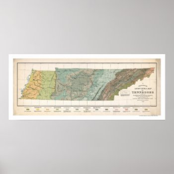
From the largest and most comprehensive cartographic collection in the world, Zazzle brings you this commemorative poster print featuring a large scale reproduction of a map of Tennessee agriculture based on the distribution of geological formations in 1896.
Continue reading
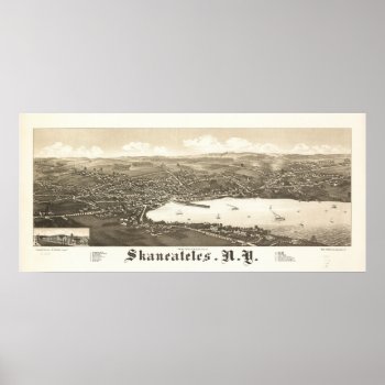
1884 Panoramic Map, a birds eye view of Skaneateles, NY. See my Zazzle store to find your Panoramic Birds Eye View Map.
Continue reading
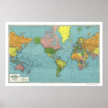
From the largest and most comprehensive cartographic collection in the world, Zazzle brings you this commemorative poster print featuring A highly detailed map of the world based on Mercator's Projection; showing the areas occupied by Germany during World War II. a map references principal railways, shipping routes (distances in nautical miles), coaling stations, wireless stations, etc.; created in 1942.
Continue reading
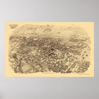
From the largest and most comprehensive cartographic collection in the world, Zazzle brings you this commemorative poster print featuring a panoramic view of the city of Pasadena, California was originally produced by Wm. R. Staats Co. in 1903. The map identifies points of interest in Pasadena more than a century ago. The printed detail is outstanding.
Continue reading

Texas – Panoramic Map – Texas was created in 1866. This image depicts scenes from Texas.
Continue reading

A classic image from Zazzle's extensive collection of over 3,200 panoramic photographs, depicting iconic scenes from all fifty states. This commemorative poster print features a reproduction of an original panoramic photograph of the Rockville Bridge, taken in 1905. The Rockville Bridge is a railroad bridge crossing the Susquehanna River just north of Harrisburg, Pennsylvania, and is the longest stone arch railroad bridge in the world. It celebrated it's 100th year anniversary in early 2002, and is still in use today.

Panoramic view of Lisbon, Portugal

Europe – Panoramic Map – Europe was created in 1769. This image depicts scenes from Europe.

From the largest and most comprehensive cartographic collection in the world, Zazzle brings you this commemorative poster print featuring a reproduction of an early map showing the routes around the world of Sir Francis Drake between 1577 and 1580 and Thomas Cavendish between 1586 and 1588 with 2 ancillary maps showing landing at California and Java, 2 ancillary views showing Drake's welcome at Moluccas and Drake's ship cast up on the rocks near the Celebes; created by Jodocus Hondius in 1595.